Saturday, July 16, 2022

The Bluenose (II), Lunenburg Harbor, and Fisherman's Memorial

Last month, for both my birthday and Father's Day, my family took a sail on the Bluenose II. We had all seen the Bluenose II at dock many times, but never had the opportunity to sail aboard her. It was a lovely morning, with good wind for sailing, and beautiful views of Lunenburg harbor. 

For those of you not familiar with the Bluenose, let me explain. The original Bluenose, a Grand Banks schooner, was built in Lunenburg in 1921. She was designed by William James Roué to both fish and race, and specifically to compete in the International Fisherman's Cup, a race for working fishing schooners. (The name "Bluenose" comes from an old nickname for Nova Scotians.)

The Bluenose was a working fishing vessel, bringing in cod from the Grand Banks. But she was also legendarily fast, winning the International Fisherman's Cup in 1921 and beating out the American competition, as she continued to do for many years, including in the last race in 1937.

The Bluenose holds the honored spot on the back of the Canadian dime, including the traditional design circa 1937, and the 100th anniversary design released last year and pictured here on display next to the Bluenose II. 

Okay, but why II? The original Bluenose was sold to the West Indies Trading Company in 1942 and converted to a freighter. Tragically, she foundered on a reef off the coast of Haiti in 1946. The Bluenose II is a replica, built in 1967 (and then significantly rebuilt in 2013).

So we were thrilled to have the chance to sail on the Bluenose II. I grew up with songs about the Bluenose and ships like her (e.g. Bluenose by Stan Rogers and Wooden Ships & Iron Men by Jim Hanlon), and we sang snippets from them as they fit the moment.

The ship herself is beautiful, with so many details that catch the eye.


Most of the ship is built from local Nova Scotian wood, but the masts are built from Oregon pine.


Here's one of the dories, the boats actually used to fish (as opposed to carrying the fishermen and fish).


Of course, while aboard, one doesn't get a good view of the ship herself in full sail... (and actually, they only hoisted four of the eight sails).


But one does get really lovely views of the harbor...


Old Town Lunenburg is a UNESCO World Heritage Site, and the waterfront is particularly iconic, including the Fisheries Museum of the Atlantic...


Which includes the Theresa E. Connor, Canada’s oldest salt bank schooner.


She's topped by colonial flag of Canada, known as the Canadian Red Ensign, which started as a specifically naval flag, although it was adopted more generally as a national symbol and flag until it was replaced by the maple leaf flag in 1965.


Meanwhile the Maude Adams is a working fishing vessel...


And the Picton Castle is a retrofitted metal tall ship. She is currently used as training vessel and is very impressive with all her sails raised.


In a another numismatic connection, the Lunenburg waterfront was pictured on the back of the $100 bill from 1976 to 1988.


As we got under sail, we noticed a creature peaking out from the water. At a distance, it was hard to tell what it was. While harbor seal seemed like the most obvious answer, it seemed maybe larger than a seal, disturbing a fair bit of water. 


But from the photos, I realized that was because there were two seals!


They seemed to be having fun!


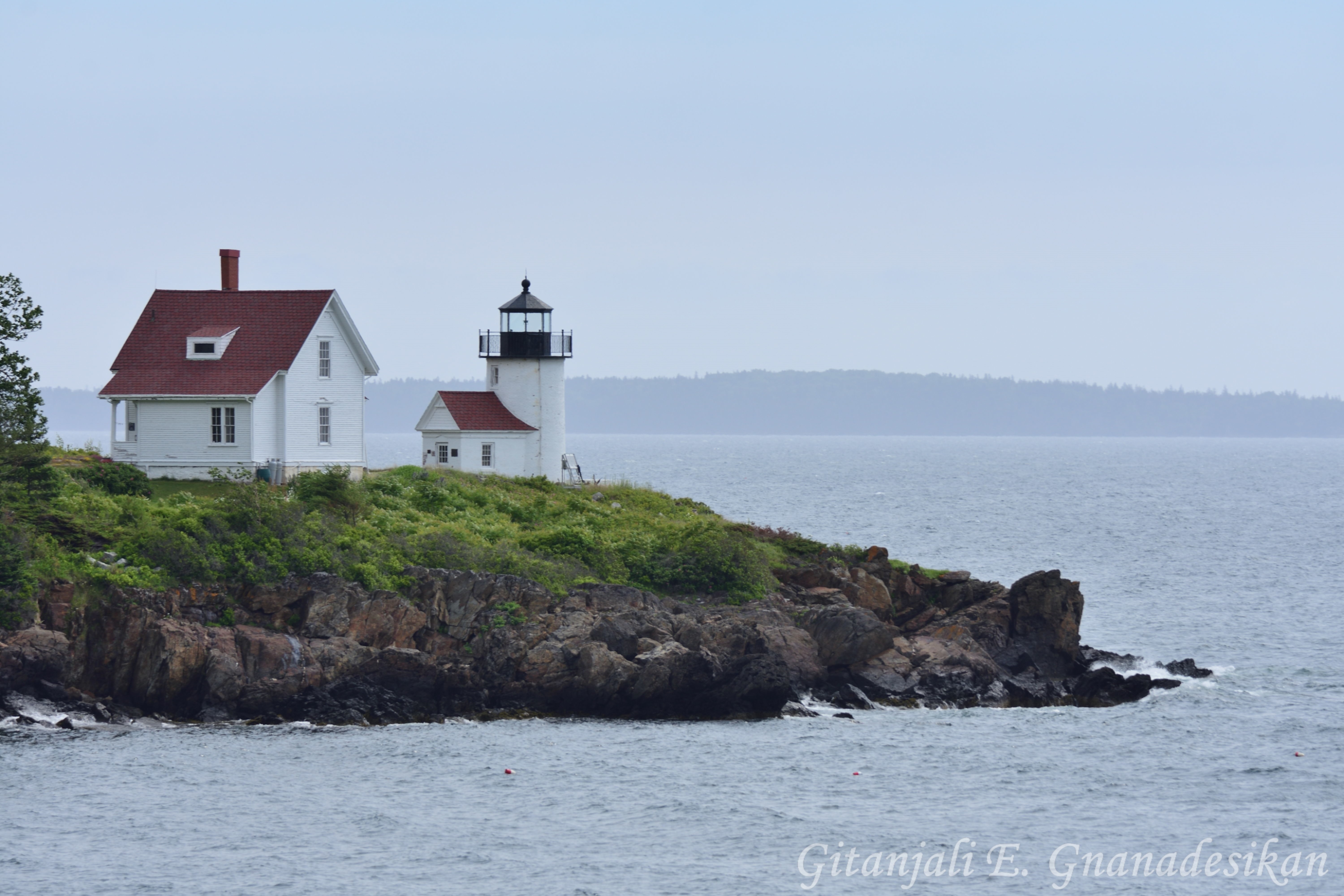
As we turned back towards the harbor, we sailed right past the Battery Point Breakwater Lighthouse.


We saw several other sailboats out and about...


And after about two hours, we returned to Lunenburg. 


Also at dock was the Pride of Baltimore II, another beautiful replica wooden tall ship, in this case a Baltimore clipper topsail schooner, with heavily "raked" (angled) masts.


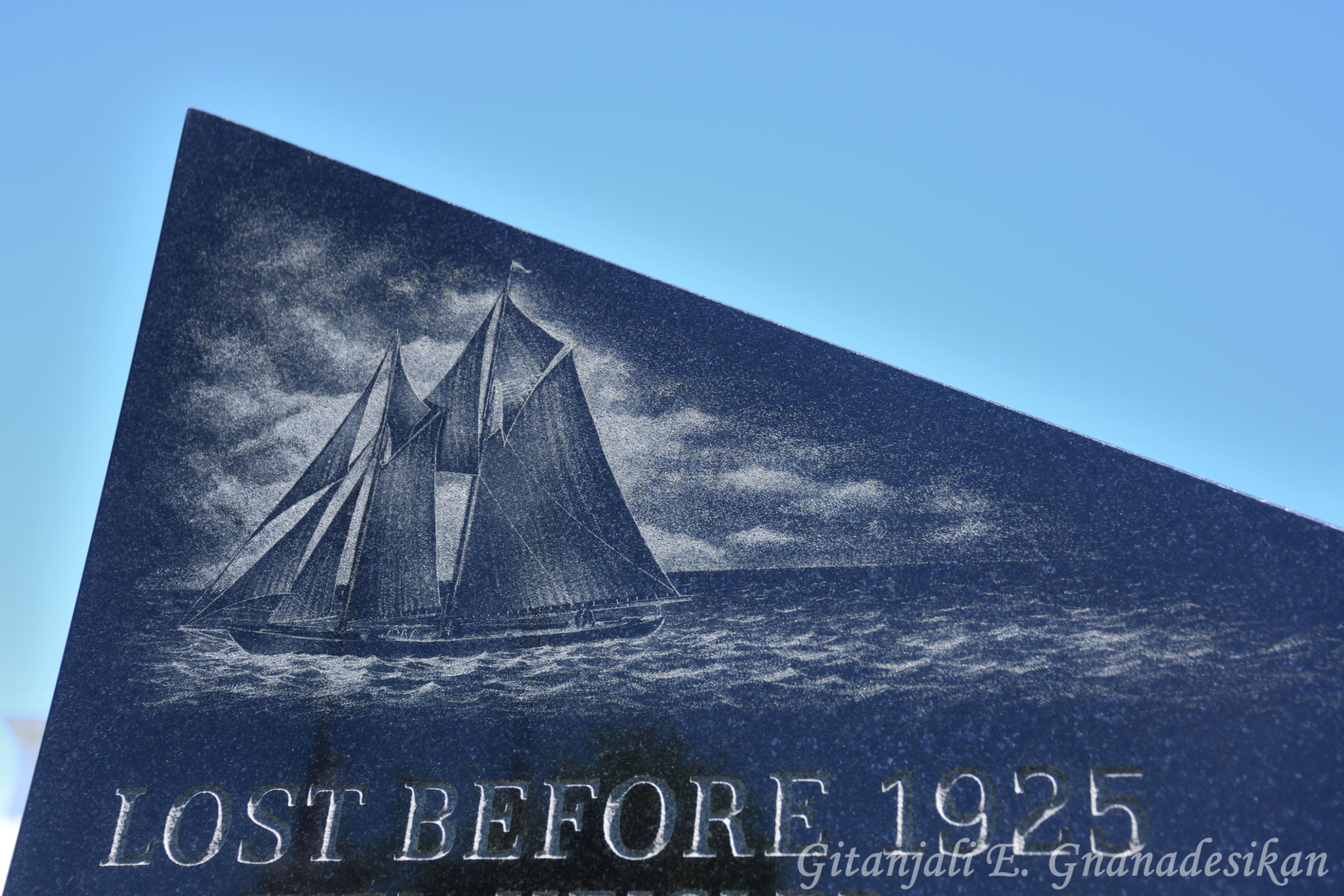
Finally, near the docks, there is a fisherman's memorial, honoring ships and local fishermen lost at sea through the decades. It is a beautiful monument, shaped as a compass rose, with a tragic number of names. 


Each stele is also inscribed with different types of fishing boats.


The original Bluenose is, of course, among the vessels lost.


"Dedicated to the memory of those who have gone down to the sea in ships and who have never returned and as a tribute to those who continue to occupy their business in great waters."


That's all for now, and it was probably a bit much to cram into one post. But I hope you learned something about the Bluenose and Lunenburg! (I know I did while writing this!)

Monday, July 4, 2022

Lighthouses of Maine and Nova Scotia

I've always loved lighthouses. I'm not particularly sure why; perhaps it was the combination of general family appreciation, their nearness to large bodies of water, and spending a lot of time on Cape Cod when I was young. Anyway, when I was looking for things to do in Maine to break up our road trip to Nova Scotia, lighthouses seemed like an obvious answer. There are apparently 57 active lighthouses in Maine and over 125 in Nova Scotia! (A century ago there were over 170 in Nova Scotia, but many have been lost over the decades.) We ultimately saw five lighthouses in Maine, one in Nova Scotia (as well as a non-lighthouse lighthouse-like structure), and one (not pictured) in New York. Hope you enjoy!

First up, Nubble Light, also known as Cape Neddick Lightstation... 


Nubble Light was completed in 1879, electrified in 1938, and automated in 1987.


It has long been a tourist attraction, basically since the moment it was built.


The keeper's house is of the Victorian era, complete with gingerbread trim.


Although not quite as well known as the Portland Head Light (which we did not get to this trip...next time!), Nubble Light is one of the most often photographed lighthouses in New England.


And from there—on a clear day—off in the distance, you can also see Boon Island Light. At 133 ft (41 m), it's the tallest lighthouse in New England.


Boon Island is a tiny little island about six miles offshore, and the site of many shipwrecks throughout the 17th-19th centuries. Many lighthouses were constructed over the decades, but the one that remains was built in 1954-5.

Camden, Maine is a cute little town built around a working harbor, with a remarkable number of old wooden ships. The harbor is sheltered by Curtis Island at its mouth (to the right)...

On the far side of which, overlooking Penobscot Bay, sits the Curtis Island Light.


This lighthouse was built in 1896, replacing one that was originally built in 1835.


With the advent of GPS, radar beacons, and other electronic aids, lighthouses have become somewhat (but not entirely) obsolete, and the coast guard has slowly decommissioned and sold many of them. 


Happily, the Curtis Island Light is now owned by the town of Camden itself. (Whereas Boon Island, for example, is owned by a private individual.)


It's worth noting that although the lighthouse is on the far side of the island, and thus not visible from town, there is a convenient viewing site (although you can also take a boat out from Camden, if you're so inclined).


As we were sitting there, taking it all in and watching the waterfowl (loon photos coming), suddenly a couple flags peeked out above the lighthouse...


And the windjammer Angelique emerged!


Less than 10 miles to the south is the town of Rockland, which maintains an active port, including ferry service to Vinalhaven, North Haven, and Matinicus. Their breakwater is almost a mile long (you can walk the length of it, although I didn't get the chance this time), with a lighthouse at its furthest point: Rockland Breakwater Lighthouse. The breakwater itself was built over the years 1880-1890, with the lighthouse added in 1902.
 

And just a little further south, on the other side of Rockland Harbor, is Owls Head Light.


Owls Head was built in 1852 (replacing one built in 1825) atop a tall bluff, which means the tower itself didn't have to be very tall. 


It's only 30 ft (9 m) tall, although the focal height is 100 feet (30 m) above mean sea level!


This lighthouse is not connected to the keeper residence, but is instead up a flight of stairs to the top of the bluff. Apparently, for a few decades in the early 20th century, there was a covered passageway, but it was removed soon after the light was electrified.


Owls Head still uses a Fresnel lens (note the texture of the lens panels in the photo below), even though it was automated in 1989. It can be seen for 18 miles!


Between the house and the light, there is a marker for Spot the Lighthouse Dog, who was taught to ring the fog bell and apparently helped a mailboat steer clear during one particularly blustery storm.


Unlike the rest of the lighthouses, this one is still owned by the Coast Guard.


And has the property tag to prove it!


Although the surrounding area is a state park. Here's one final view of the light.


While we were visiting Owls Head, we saw the schooner Heritage sail by...


And as it started raining, we could make out a couple more sailboats in the distance, demonstrating just how helpful a lighthouse would be in such conditions!

We also saw one active light house in Canada, the one in Lunenburg harbor: Battery Point Breakwater Lighthouse. This little light was built in 1951, the third in a line of lighthouses that began up on Battery point in 1864. Here it is as we were leaving the harbor...


And returning (more on the sail itself soon). Yay for solar power!

We also saw this lighthouse-shaped structure, somewhere out by Blue Rocks.

Lastly, unpictured, but spotted from the Tappan Zee bridge: Tarrytown Light. Which I didn't even know existed until reading up about local lighthouses (despite having crossed the bridge many times in my life). I hope to stop and see it on a future trip!