Here's the view from near the trailhead, looking out along the ridge to Horseshoe Mesa and beyond.


You can just make out the Colorado River in the distance here and in the next shot.


This section of the canyon wall reminded me of photos I've seen of Antelope Canyon (a slot canyon near Lake Powell, which we didn't manage to squeeze into this trip but I hope to see in the future).


This view highlights the transitions between contrasting layers of rock. Particularly visible here is the boundary between the pale Coconino Sandstone and the deep red Hermit Shale below it. The sandstone formed approximately 275 million years ago, while the shale formed about 280 million years ago.

Here is a closer view of the "Sinking Ship", seen off to the east. I was interested to discover this was its name, because there's also a feature called the battleship, and when I saw this I thought to myself this looks even more like a battleship.


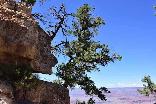
And nearing the rim again.


I am always in awe of how plants thrive in unlikely and inhospitable places.


 |
| A close up of some features along the north rim. The major ones, at least, are named, but I'm not sure which one is which! |
You can just make out the Colorado River in the distance here and in the next shot.


In addition to the views, the Grandview Trail itself is very pretty and a pleasant hike down, though much more strenuous on the way back up.


This section of the canyon wall reminded me of photos I've seen of Antelope Canyon (a slot canyon near Lake Powell, which we didn't manage to squeeze into this trip but I hope to see in the future).

It's so interesting to see all the canyon features from different angles as you descend. Of course, this is always true with hiking, but somehow it's particularly striking when you travel in what is opposite the typical progression--from the top down, rather than the bottom up--and when the landscape is so intricately carved.
 |
| What we had looked down on from the top is now in front and above us. In the background is a feature known as Sinking Ship. |


 |
| A USGS survey marker. We went only a little ways past this. |

 |
| Another case of seeing from below what we previously saw from above. And it looks so different! |
 |
| Horseshoe Mesa is in the right foreground, with the unseen Colorado River and the very visible north rim beyond it. |


This view highlights the transitions between contrasting layers of rock. Particularly visible here is the boundary between the pale Coconino Sandstone and the deep red Hermit Shale below it. The sandstone formed approximately 275 million years ago, while the shale formed about 280 million years ago.

Here is a closer view of the "Sinking Ship", seen off to the east. I was interested to discover this was its name, because there's also a feature called the battleship, and when I saw this I thought to myself this looks even more like a battleship.


And nearing the rim again.


I still have a bike ride, another hike, and lots of flora and fauna to share with you all!


